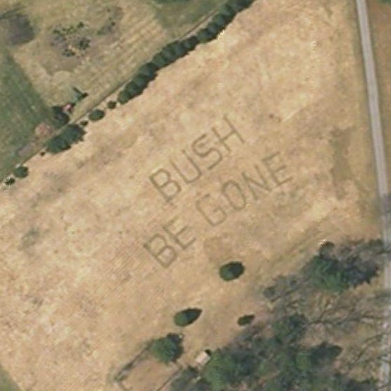
Hah! Some farmers in rural Massachusetts did a little creative mowing a few months ago, a satellite captured the field on one of its mapping passes, and now anyone can read their message by poking around Google Maps and looking at the satellite imagery.