
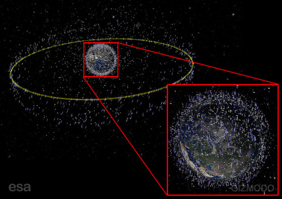
The European Space Agency just released some graphics showing a fairly comprehensive display of the satellites and orbital debris surrounding Earth.
Of course it seems amazing that there’s so much junk flying around up there. But I’m not very surprised, because I did exactly this back in 1998 or so.
Those were my days at Raytheon Space Systems, where I wrote (amongst other things) software to do orbital analysis and 3D visualization of satellites. For fun, I decided to get the full catalog of satellites from all countries and drop their orbital information into the simulation. The result was a graphic almost identical to the ESA one shown here.
Strangely, I didn’t get the same press they’re getting now. I guess it’s because I was just a brilliant but somewhat quirky analyst working in the bowels of an aerospace giant instead of a multinational space agency. Go figure.